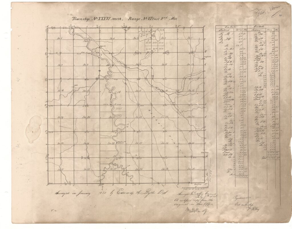
It is critical to know the long history of the land and who cared for it before me. As I started tending the acre we purchased in 2013, I began to reflect more deeply about the longer history of the land and who cared for it. In my quest for more understanding, I came across maps from 1830 and journal entries by the early settlers in Elkhart County, IN. I continued (and still do) to look for information about the Indigenous People whose land I reside on. I found the treaty that was signed in 1828 with the Potawatomi. I also learned how they lived on the Elkhart Prairie and in villages along the Elkhart River. I will share some of my findings with the goal of honoring the Indigenous Peoples who have inhabited this region since the recession of the last glacier.

Close examination of this map shows the Elkhart River and the Elkhart Prairie. The surveyors also noted a “road” passing through the Elkhart Prairie. Some other maps of this era call the “road” an Indian Trail. This is a route that was used for many centuries by the Potawatomi and Miami People and other Woodland Tribes. It was a major trade and transportation route from the Maumee River (Fort Wayne, IN) to the southwestern corner of Lake Michigan (Chicago).
I have been working with a group of people since 2021 to mark the trail in honor of the Potawatomi and Miami People. This is a link to the website we are developing about the trail.
I live in the southwest corner of Section 22 of the above map. Downtown Goshen, IN is in Section 9.
